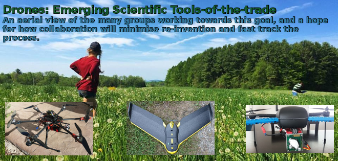
Drones: Emerging Scientific Tools-of-the-trade
By: Jane Wyngaard and Lindsay Barbieri
We’re just under 1 week away from the Research Data Alliance’s 9th Plenary in Barcelona. This will be our second RDA plenary, and more significantly, it will be the first RDA plenary to have a small Unmanned Aerial Systems (sUAS) session.
The wild west of science drones
Those in the RDA sUAS IG and ESIP Drone Cluster already know that its co-chairs (Bar and myself) have been discussing the need for standards and data workflows in the sUAS realm for quite some time. Recently, we were able to separately attend two notable events: 1. the North American Unmanned Aerial Systems for Atmospheric Research Workshop hosted by the National Center for Atmospheric Research (NCAR) Earth Observing Lab (EOL) 2. the European Union based OPTIMISE (Innovative Optical Tools for Proximal Sensing of Ecophysiological Processes) annual meeting. Between these events, and the last 12 months of active sUAS networking, we’d like to think we have a good grasp on the current state of, vision for, and challenges remaining for the diverse, interdisciplinary sUAS community. And we want to share this knowledge, as we all work to shepherd drones into a legitimate place in the science toolkit.
(If you’re already working in this space and so already know why this is important, skip down to the details in Communities already taming this space )
The use of drones - and especially the new plethora of small (~<25kg) sUAS - for data capture is opening doors to monitoring parameters that were previously unreachable, for both physical and economic reasons. Eventually these systems will become a commonplace tools most physical sciences.
For now, however, as a new domain it’s not surprising that there are open questions and missing pieces. For the academic science community that this blog is concerned with, we’ve seen a number of communities wrestling with a need for the following holes to be filled. Depending on your arena, they will rank differently in importance and urgency. And the work of filling 1 hole for one community will easily double in serving others, while in other case custom solutions are needed for each sensory challenge.
- Standard flight procedures for different data: Well tested and defined best practice methodologies and procedures for flying various sensors on sUAS.
-
Standard sensor calibration and use procedures: Calibration and use procedural best practices and standards are needed. Sensor specific guidelines should be provided by the manufacturer, however, the community should define sensor operation and maintenance, and metadata requirements for different sensor genesis.
-
Standard data post processing and error analysis procedures: It’s relatively easy to introduce unintended error and artifacts into your data when processing it, we need to both describe best practices and quantify acceptable error tolerances for the primary sensor taxonomy branches and the associated processes.
-
Standard data formats and metadata requirements: These are needed in order for sUAS captured data to be easily made Findable, Accessible, Reusable, and Interoperable FAIR, per standard good scientific data management guidelines. Having such will also; lower the barrier to entry in using sUAS for science, and open the door wider to science sUAS specific software and hardware development by making it easier for developers.
-
Standard operating guidelines: While many countries have begun to settle on regulations regarding operation of sUAS in their airspace, most organisations are still in the early stages of writing their own internal policies and protocols. Aside from liability legality issues, a self governing science sUAS community will go a long way to developing goodwill with the public, especially as privacy and military concerns around sUAS remain.
-
Introductory information and education: As the domain grows their in an increasing demand for introductory information regarding the multitude of new expertise needed to even begin entering this space. For to sUAS to become a ubiquitous and safely used tool of the trade, we need to begin equipping new members.

The accumulation of error in a “typical” remote sensing information process flow (Congalton 1991)
Along with others in the academic sUAS space, the ESIP Drone Cluster has been exploring the above needs for the past ~2 years. But this is not about any single organisation declaring what is best. As with all questions of standardisation - at the heart of the issue and a fundamental requirement for success in addressing it - is the need for community wide discussion and development. The following sections therefore are an attempt at summarising the current state of the diverse sUAS communities working on such. We hope this will serve to enable greater collaboration and thereby more rapid progress.
If we can develop the above, as a community we stand to reap significant rewards. Namely, (1) all the benefits of sUAS for the sciences become far more accessible, and (2) if properly managed the data captured has a magnified impact as multiple further tiers of users access new data sources. Alternatively, if we don’t go through the mundane and needed process to do the above soon, we are going to (a) miss out on many opportunities to carry out crucial and urgent science, and (b) be left still needing to do so with the added burden of having to rescue as much - by then legacy - data as possible. There is also a third potential cost to delaying (c) that of allowing a small number of commercial providers to lock the academic community into their ecosystems (through momentum), which may well limit innovation, accessibility, and openness.
Fortunately, there are already multiple groups pushing forward on these challenges. Out of a need to see a more global conversation on these issues take place the Research Data Alliance sUAS data Interest Group was established at the beginning of this year to facilitate these necessary conversations and collaborations. As it’s co-chairs, we have been privileged to witness many of the various efforts currently underway. In this blog we share some with you in the hope that you and others will both join in the conversation.
Before delving in any further therefore, or losing any more readers, if any of the above rings true for you please consider doing any or more of the following:
-
Join the RDA sUAS Interest Group mailing list and comment.
-
Join us for our RDA kickoff session next Wednesday 5 April at 2pm CET (gotomeeting link, or even better come to Barcelona if you’re close enough).
-
Join our next ESIP Telecon where we’re currently planning a collaborative workshop to pool efforts in the N. American region at the next ESIP summer meeting (24 July 2017)
Communities already taming this space
Atmospheric Sciences
Over 100 members of the atmospheric community recently gathered at NCAR in February for a UAS in Atmospheric Science Workshop. Given this community’s focus on collecting in-situ atmospheric data, the outcomes of this workshop offered an ideal starting point for characterizing the broader challenges of in-situ sUAS data capture. Covering high altitude, large scale UAS (e.g. Global Hawk) through to small scale sUAS (e.g. DJI Phantom), the range of flight and sensor scenarios this community works with are illustrative of most of the in-situ data capture challenges.
At the Workshop, four major UAS categories were discussed:
-
Platforms: The discussion was framed around the fact that science questions should drive platform selection rather than current available platforms limiting science goals. This showed gaps in the current platforms available, and lead to discussions on the tradeoffs of utilising “off the shelf” as opposed to custom-made platforms optimized for a specific science mission. At present, the atmospheric community tends toward self built systems (or heavily modified commercial systems) especially on the smaller sUAS scale, for more control in optimising the ability to carry a variety of sensors.
-
Sensors: A discussion of both typical and novel instrumentation systems for UAS centred particularly around examining wind measurements derived from UAS autopilots as compared with other sensors. Accurate wind measurements are essential in monitoring many of the parameters of interest to Atmospheric Scientists, but is an as of yet unsolved problem on UAS. This community also deals with needing many sensors all working in tandem in order to collect meaningful information (e.g. pressure, temperature, humidity). Furthermore, duplicating this sensor suite for even more precise and validated measurements seems desirable to this community. As with other sectors, the need for authoritative calibration procedures for UAS instruments was also often voiced.
-
Operations: The discussion around UAS operational practices, and how to fly in hazardous atmospheric conditions dominated these sessions. Similarly, understand and remaining current with the evolving FAA UAS regulations and requirements was a notable challenge. The FAA regulations regarding operating beyond visual line of sight is especially a particular barrier to this community. While the FAA in the USA has made significant progress, and made commercial UAS operation notable less onerous than in other countries, the regulatory landscape remains a huge obstacle.
-
Science: The discussion of the key areas for UAS in atmospheric research included; forecasting, flux measurements, pollution, constituent measurements, and boundary layer-atmospheric interfaces. A more comprehensive review of the science questions of interest can be found in the (Survey Report). Many researchers noted that they communicate their work most often through conferences such as the American Meteorological Society (AMS) Annual Meeting, but also at more specialized Engineering and Atmospheric meetings such as those hosted by: The International Society for Atmospheric Research using Remotely piloted Aircraft (ISARRA). This is a relatively new group, attempting to support “Knowledge Exchange within the science community on the use of RPAS (remotely piloted aircraft systems) for atmospheric and environmental research through meetings, web site and mutual support.”. They appear to be successfully gathering momentum, with members from organisations across the planet and attendance at events such as the American Meteorological Society (AMS) Annual Meeting and this NCAR/EOL UAS Workshop. They will be hosting their second annual meeting in May, including both meetings and a “Flight Week” of co-operative experimentation and development.
#Takeaway-Atmosphere Science Comunity
The atmospheric sciences community is perhaps one of the more well formed communities using sUAS. The anticipated report back from the NCAR/EOL workshop will further codify the current state of this community’s knowledge, and serve as a road map forward. NCAR, while not yet officially involved in sUAS research may play a significant future role in providing the interface between the science, technical and logistical issues of operating sUAS. In fact, the input from workshop participants was a request for exactly that. The need for calibration and validation of UAS and Instrument measurements was probably the most important theme, followed by a desire to pool community knowledge around UAS instruments and platforms.
Remote Sensing and Spectral sensors
Complementing the Atmospheric community is the terrestrial focused global body of remote sensing experts. This broader community offers decades of operational experience in spectral sensing at every altitude from; satellites, through manned and unmanned aircraft, to towers, balloons, kites, and finally including ground based systems. These experts have been monitoring biological, geological, and hydrological systems using the EM spectrum for decades. While use of sUAS is novel and introduces new procedural components, but can adopt many aspects already in use.
OPTIMISE (a EU wide project focused on spectral sensors currently in its 3rd funding generation) recently hosted its annual meeting. Most notable to this effort, Dr Helge Aasen presented “Best practice for UAV Spectral sampling (BUS) concept and overview of current status” showing OPTIMISE’s work thus far on developing procedural standards. As a demonstration case this has focused on Solar-induced chlorophyll fluorescence (SIF) retrieval using sUAS mounted sensors. OPTMISE has now hosted 4 workshops specifically to explore meeting the full stack of needs for robust and transparent; Instrument classifications, Retrieval methods, Measurement protocols, Post processing methods, and Qualifications of transferability between different instruments and scales.
#Takeaway-Spectral Sensing Community
OPTIMISE’s work on SIF retrieval is ongoing but when published will in all likelihood represent the most extensive qualification of an optical sensing standards sUAS stack, and should serve as a significant reference in the development of similar for other spectrally sensed targets.
The ESA and NASA clearly also have much to contribute to this conversation. Both have worked with OPTIMISE on various tasks in the past. Further input, particularly from their manned remote sensing aircraft programs, will be of significant value to the sUAS community.
Underwater Unmanned Gliders
Given the similarities between Underwater Unmanned Vehicles (UUV) and sUAS (there are UUVs that even run the same open source autopilot many sUAS use - Ardupilot), we could choose to utilise much of this communities forerunning work as a template for our own development. Two groups of particular interest are presented here.
IOOS
The US Integrated Ocean Observing System (IOOS) operates the U.S. IOOS National Glider Data Assembly Center (NGDAC), which has published a Github wiki detailing all the data requirements for submitting data to their data servers.
Similar to what the Atmospheric Sciences community appears to be currently informally doing with their sUAS insitu data (using NetCDF to archive data), IOOS developed a NetCDF file format specification (IOOS_Glider_NetCDF_v2.0.nc) to archive and distribute (real-time and long-term) insitu data sets captures on UUVs. Their primary motivations in this were to; (i) ensure complete metadata records were created and kept, (ii) provide a simple file format that is easily created, (iii) provide a sufficiently flexible “specification to allows for the creation of compound data products that result in easier, more intuitive methods of access by a wide range of end-users and in a variety of formats (i.e.: csv, tsv, json, geoJson, etc.), (iv) “preserve the original resolution of the data sets.” All of which are appropriate for sUAS.
Under the IOOS ecosystem, uploaded files are aggregated into single data sets representing an entire deployment and disseminated via the ERDDAPP and THREADS data servers. To upload data it is required that this data; include mandatory global attributes and variables, follow the ISO 8601 standard in the use of time and date stamps, use their file naming convention, and use the CF convention in labeling parameter.
Figure1 shows how the UUV community collates its data. Data must be submitted as 1 NETCDF file per profile, which the data servers aggregate into single trajectory data sets. Perhaps for sUAS, we might adopt a similar approach in which a vertical sUAS profile flight’s data is stored in a single file, and multiple profiles (flights) are collated into a single data set. But in this scenario, where a single deployment (trajectory) defines the data set for UUVs, what should define a data set for sUAS? Perhaps all flights for a given experiment (over days/weeks/months?) at a given GPS defined location (within what tolerances, 5m/cm/less?). Or perhaps all profiles captured in the same ‘sample field’ (to be defined as?), on a given day should be collated? Or, there are many other arrangements that might be envisioned. Further, what is the equivalent protocol to be taken with predominantly horizontal (‘survey’) rather than vertical type flights?

Figure1: https://github.com/ioos/ioosngdac/wiki/Glider-Background-and-Sampling-Te...
NSF UUV video workshop:
In 2016 the NSF funded a workshop on “Establishing Community Standards for Underwater Video Acquisition, Tagging, Archiving, and Access” (Final report pdf). The workshop had 3 goals: (i) understand the current state of practice with respect to underwater video acquisition, logging, annotation and use, (ii) understand solutions and workflows that are in use in the scientific and commercial sectors that could be broadly applicable, and (iii) generate recommendations for best practices that will incrementally move the community toward a common goal of openly accessible underwater video archives that are suitable for science and public engagement.
Through a broad sector wide survey and 2 day workshop they accomplished just that. The primary outcomes being; a clear visioning of what is now technically possible and community desirable in terms of video data management for research enablement, a collating of different currently ongoing community efforts, and a qualification of what is needed in the future.
This effort was motivated for with the statement “Even though fully accessible online underwater video archives may lie far in the future, there is significant benefit to laying the groundwork for such archives now in order to mitigate costs, gain efficiencies, and facilitate interoperability.” The workshop was a significant first step for a community that has decades of data to retroactively process, in addition to the torrent of new data continuously arriving.
#Takeaway-UUVs community
The obvious overlap in interest - significant quantities of high resolution scientifically interesting “video” data - between the sUAS and UUV communities, mean both can potentially learn from and with each other. But perhaps the most significant point to be made here, is that the sUAS community should see the above as forewarning motivator to seek community consensus and collaboration on the same issues now. We are in a unique position, where the technology already exists now to adopt FAIR data practices with our data, and we don’t yet have the burden of decades of legacy data to support. The longer we go without standards the more data that will be lost to poor characterisation and offline harddrives, or will require retroactive rescue and processing at a later date.
The approach adopted by IOOS for UUVs also clearly has some very useful lessons for the sUAS community. For one, the motivations for a customised NetCDF form are appealing for insitu data but this should be debated. Secondly, their approach to missions is illustrative of a model sUAS might copy, but also demonstrates how important the questions is to address now and how there are additional factors to consider for sUAS.
ESI Laboratory
Dr Karen Anderson at Exeter University in the UK leads the ESI Drone Lab, which has been pioneering particularly the use of Opensource sUAS for science. From conversations with multiple sources, she and her lab are leading the way in the EU in terms of science sUAS training and open procedure development.
Her group recently (January 2017) published “A UK Civil Aviation Authority (CAA)-approved operations manual for safe deployment of lightweight drones in research”(Cunliffe et al. 2017).
While obviously UK focused, this is firstly a very useful resource given that most of us in this domain have either recently - or are now/imminently - working to develop sUAS policy documents within our own organisations. Secondly, it is the first paper we have seen to openly advocate for cross domain common scientific sUAS best practices. Admittedly the motivators given for this included; aviation authority requirements, funder requirements, and increasingly the need to reassure concerned land owners/the general public and to build goodwill with the same, as opposed to scientific method or innovation enablement. They argue for carefully designed sUAS deployment protocol in the form of a agreed to operations manual (OM), and for researchers to be required to demonstrate competency, safety, and reproducibility of sUAS operations.
#Takeaway-ESI
We - as a community - should agree to require of ourselves a measure of expertise and operational rigor. This will firstly ensure we meet all legal obligations and successfully migrate from the current fuzzy realm of neither quite ‘hobbyist’ nor ‘commercial’ operator to professional scientific sUAS operators. And secondly, will benefit the whole scientific community by cultivating a favourable public perception of science sUAS - as opposed to the common unfavourable views such as sUAS as military killing machines or privacy invading spy toys. Obviously, any efforts that improve private-academic relations can only be of benefit to us.
Standards Bodies
The Open Geospatial Consortium [OGC] recently (10 March 2017) published a draft Unmanned Systems Domain Working Group [UXS DWG] charter requesting comment. This is very encouraging given their organisational and historical weight in the domain of creating geospatial standards. This charter is only in draft phase so will likely evolve.
Most notable is its catch all use of UXS. Quoting from the introduction: “This Domain Working Group charter defines the role for OGC activities within the Unmanned Systems Community (herein referred to as UXS with the “X” recognizing that aerial, underwater, and other unmanned vehicle platforms are included)...” Given the overlap with UUVs already discussed this is encouraging.
Presumably due to the initial interest group‘s members there is an apparent focus on spectral sensors. We have submitted comments suggesting that, given OGC’s expertise with Sensor Web Enablement, Semantic Sensor Network Ontology, and SensorML, the organisation has much to contribute in terms of insitu and physical sampling standards. Hopefully such will be taken onboard.
One of the primary reasons it is so encouraging to have OGC enter this domain is that they have an ongoing collaborations with W3C (World Wide Web Consortium) on amalgamating the SensorML, OandM, and SSN sensor taxonomies, and on improving interoperability and integration of spatial data on the web. Both of these subjects are key to enabling some of the technical infrastructure that sUAS data management needs.
#Takeaway-standards bodies
The OGC charter membership list also does not currently include any of the most prominent commercial or opensource industry sUAS players. However, given the OGC’s industry context, this will also hopefully change in the future. Overall, it is really encouraging to have a well established standards bodies recognise the growing need for standards in this domain. We are hopeful collaborative efforts between them and the other groups already advocating in this space will develop, and lead to unified efforts and community driven standards that see widespread adoption.
Agriculture
USDA
Ray Hunt gave an overview(pdf) of USDA Ag Drones at the 2016 ESIP Winter meeting. Agriculture is a sector that is very familiar with using imagery for productivity monitoring, and most growers of high-end crops already use aerial photographs for monitoring. It is unclear what the rate of adoption of using sUAS in agriculture is and the USDA appears skeptical that sUAS providers will be able to offer comparable and imagery data at a lower cost. However, as technologies advance and become more ubiquitous it’s highly likely that more farmers will have sUAS in their suite of tools. This was substantiated by the prominent inclusion of sUAS discussions within the 2016 Precision Ag Council at AgGateway.
Additionally, in agriculture there is potential for sUAS use in pesticide application. Combining remote sensing with aerial application of pesticide could be very important in more adaptive and efficient spraying, which may reduce the amount of pesticide needed.
AgGateway: Precision Ag Council
The Precision Ag Council works in many precision realms (e.g. irrigation, fertilizer spreading) - however, their Geospatial Working Group has been advancing the conversation around standards in agricultural sUAS use and imagery metadata. Overall, the Precision Ag Council is well poised to contribute, based on their mission of “enabling the industry to collaboratively identify, develop and promote a set of global industry standards, guidelines and implementation practices for precision ag, with specific focus on the standards required to facilitate data sharing among value chain partners. Having and utilizing these standards will allow industry partners to more rapidly develop and innovate around the precision agriculture and decision support systems concept.” And with the specific goal to “Facilitate the development of industry standards, guidelines and implementation protocols to enhance the ability of end users to capture the value of the precision technologies and systems.”
This community is interested in addressing data challenges within sUAS, is collaborative, and interfaces with OGC (recently attended their meeting in Delft where the draft UXS WG charter was discussed) and RDA (attended Plenary 8 and International Data Week). Also they have strong ties with SenseFly (below).
SenseFly (Ag Department)
A commercial sUAS company, SenseFly has set itself up to be one of the prominent agricultural sUAS Platform of choice, with platforms designed for farm workers in mind (easy to use, autonomous, multispectral imagery, post processing for crop monitoring indexes like NDVI).
#Takeaway-Agriculture Sector
This summarizes some of the communities we have the closest ties with in the sUAS Agricultural space, but is by no means exhaustive. This list is currently weighted on the agricultural production and North American sides. However, there is potential for use in monitoring climate and environmental impacts of agriculture. Bar recently spoke about her research on such for example.
Something to be considered by those developing solutions for this sector particularly is the potential differences, globally, in sUAS use case and end data users. Where very large scale precision agriculture is the norm, the centimeter precision crop health and soil moisture metrics, and accurate biomass estimates that sUAS can provide are beneficial to farmers. Procedure and data standards for these areas will, however, differ to those needed in serving mid-sized farming regions that aren’t don’t need or aren’t equipped to utilise such fine resolution data. Similarly, in areas where farming activities are very small scale subsistence and/or urban based, the flight procedures needed will clearly again differ, as will the data product generation as the end user may be government concerned with food-security or regulatory issues rather than efficient farm operation.
NGOs
The NGO sector is justifiably not as concerned with scientific rigor as academics need to be. However, this domain is possibly the largest contributor of basic “how to get going” information resources. There are multiple semi-formal ongoing efforts to the ends of; efficiency, greater use, and community safety, we highlight 3 efforts here.
UAViators: Humanitarian UAV Network
UAViators exists to “...promote the safe, coordinated and effective use of UAVs for data collection and cargo delivery in a wide range of humanitarian and development settings.” . They maintain a map of crisis around the world that their members are involved with here.
In support of this goal, they also started a number of open editable Google Doc based resources collating information on flying sUAS. The standing invitation to the community is for anyone to work to improve and update these documents so as to maintain a current set of collective best practices.
Their handbook on operational best practices, includes information and links regarding everything from flight checklists, through handling international travel with sUAS equipment, operating legally and ethically in other countries, taking suggested operational safety measures, and flight planning guidelines. Their spreadsheet of hardware resources has links to suggested cameras, sUAS platforms , GPS systems, and data processing software suggestions (predominantly related to imagery). ANd finally their “Software for humanitarian UAVs/Drones” contains information on autopilot software, ground control stations, and further resources for post processing imagery.
Conservation Drones
Conservation Drones “seeks to share knowledge of building and using low-cost unmanned aerial vehicles for conservation-related applications with conservation workers and researchers worldwide, especially those in developing countries.” To this end they host many pages providing lots introductory information on again building sUAS, adding sensors, and processing the data.
Wildlabs
Wildlabs recently made a call on twitter and their forums for a pooling of community effort in creating a living guidelines document for best practices in using sUAS for conservation. This currently consists of collating threads from their forum into Google Docs; a thread on mapping caves in 3D has been moved to Drones to GIS workflow, and another on developing institutional operational manuals (which references the ECI paper discussed earlier), has become 3D UAV mapping: getting started.
#Takeaways-NGO community
The challenge these groups face is a lack of co-ordination and awareness of each other, along with the fact that as predominantly volunteer run groups people simply have very limited time to contribute. For instance UAViators best practices handbook, despite being open, hasn’t seen any updates since a few months after it was first posted. Conservation Droness’ how-to posts appear to have been static since sometime in 2015 (based on the comments sections). Or the ESIP drone cluster experienced the same when we attempted to develop a continually updated catalog of academic sUAS projects in the sciences. This too hasn’t seen any updates since its creation.
New conversations around pooling efforts are currently underway, the RDA sUAS IG was part of some looking at pooling Wildlabs and Humanitarian Drones efforts, but this is in early stages. And without significant funding it’s difficult to see how the effort might be maintained in the long term. Perhaps 1 obviously hindering factor is the lack of a truly appropriate platform?
Conclusions
We are 100% sure there are many more active google docs, web forums, and internal conversations all wrestling with the same issue. One domain, for instance, that we haven’t had any engagement with yet which is highly productive, is the polar research UAS community.
In the preface to the March 2017 special edition of the International Journal of Remote Sensing, focused on sUAS, the editors points out that while open tools exist for processing many sUAS data products, “these methods remain in their infancy, and therefore the methods for collecting appropriate datasets and turning them into useable, accurate, and repeatable geo-spatial information is an ongoing and evolving area of research.”(Unmanned aerial vehicles for environm...). As best as we can tell this state “an ongoing and evolving area of research” is true of all aspects of sUAS use in the sciences and consequently the crux of what the RDA sUAS IG is motivation for is solely that: the field has matured enough that nearly everyone agrees sUAS are a valuable new tool, but that the remaining missing pieces - such as less than science-grade data management and processing tools, and a lack of flight and sensor operation procedures, remain. And finally we propose that unless the scientific community is the one to push for and self-create soon we will all pay a high cost in the long run.
In summary:
-
There is a significant amount of material that sUAS users can adopt from the longer standing domain of UUV operation. This applies to both insitu and spectral data collection, and both data management and procedural needs. However, this material will require adaption and therefore involve significant interaction and debate between and within the communities. There is also a lesson to be learnt, that it is worth developing these standards as soon as possible to avoid data loss and creating a burden of retroactive legacy data standardisation.
-
Long standing scientific standards bodies, like OGC but also others, are only just beginning to engage with the sUAS. This is highly encouraging, although a notable missing player at the table in these discussions is industry. The academic community should make an effort to engage with industry for the sake of ensuring good data practices are provided and lowering the barrier to entry for our colleagues new to the domain. Given that the agricultural sector is in many ways the primary commercial data capturing use case for sUAS, and that at least in the USA the government is interested in capitalising on this data, there is possibly a wider open door here for the science community and industry to begin collaborations.
-
We should agree to require of ourselves a measure of expertise and operational rigor so as to ensure a successfully migrate from the current fuzzy realm of ‘semi-hobbyist’ to professional scientific sUAS operators. In addition to enabling productive operations this will also benefit the whole scientific community by cultivating a favourable public perception of science sUAS
-
For those using insitu sensors the Atmospheric Science and OGC communities have both the necessary tools and use-case examples to pioneer development and validation of standardised sensor-sUAS calibration and use procedure, as well as data management best practices.
-
Given its data management and scientific modeling context, relationship to the Atmospheric Science community, and connections to communities with relevant institutional expertise regarding technical and logistical issues of operating manned and unmanned large scale aerial systems, NCAR is possibly uniquely well positioned to play a key role in providing the interface between the these bodies and the growing sUAS community.
-
OPTIMISE’s work on SIF retrieval is likely to serve as a reference in the development of similar for other spectrally sensed targets.
-
The NGO sector is benefiting us in their support and development of non-hobbyist sUAS resources. There are perhaps avenues for infrastructure development collaborations to be made here (eg a fully open sUAS science grade stack).
-
Those with the necessary technical expertise to build the needed additional technical infrastructure (post processing tools, data archives, onboard sensor integrations, metadata capture tools, sensor calibration tools and procedures, and policy documents) are eager to do so but first need a greater degree of stand
 ardisation than is currently available to them for reference.
So we will conclude by saying, we only started on this road because we wanted to do science with drones and wanted to do it ‘right’. We would all MUCH rather be; flying drones, capturing data, and getting on with the important science challenges facing our planet and humanity - than talking standards. But, hopefully by now you also agree with us that we - the global scientific community interested in using sUAS - (1) need to have these conversations, and (2) that for our own and future scientists’ sake, it’s worth having it sooner rather than later.
So, let’s talk, and let’s make sUAS FAIR data easy to capture asap.